 how-to
How to Navigate Sandbars Safely: A Guide
Table of Contents
- Understanding Sandbars and Water Conditions
- Reading the Water to Identify Shallow Areas and Sandbars
- Using Depth Finders and Navigation Technology
- Planning Your Route Using Nautical Charts and Tide Tables
- Approaching Sandbars: Step-by-Step Technique
- How to Safely Anchor a Pontoon Boat
- What to Do If Your Boat Runs Aground
- Common Mistakes to Avoid
- Frequently Asked Questions
Last Updated: August 31, 2026
Understanding Sandbars and Water Conditions
Sandbars are underwater ridges of sand and sediment that shift with tidal currents, storms, and seasonal changes. Unlike fixed obstacles, they move significantly from season to season or after storms. Water conditions change dramatically throughout the day, tidal ranges, current speed, and water clarity all affect safe navigation. A sandbar passable at high tide might trap your boat at low tide.
At Little Philly Sea Adventures, the techniques we share come from experience navigating these waters. Sandbars form where water flow slows and deposits sediment, commonly in tidal channels, river mouths, and areas behind barrier islands. Recognizing warning signs before you get too close is what matters most.
Reading the Water to Identify Shallow Areas and Sandbars
The ability to visually identify shallow water and sandbars separates experienced boaters from those who frequently run aground. Water color, surface texture, and light reflection all provide clues about depth and bottom composition.
Visual Cues for Shallow Water
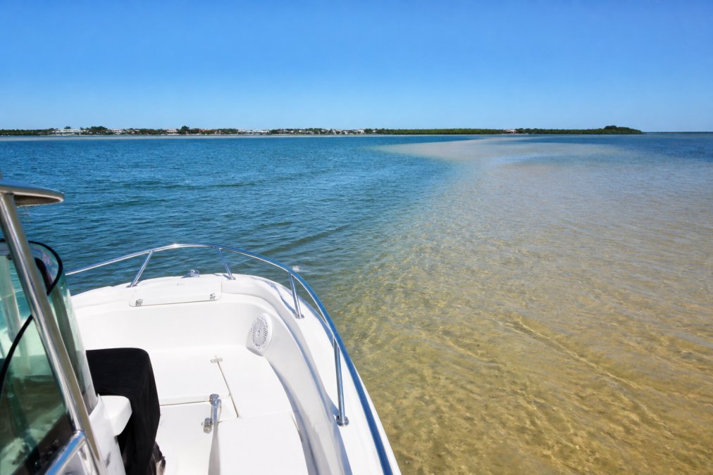
Shallow water typically appears lighter in color than deeper water. Sand bottoms reflect light and appear tan or golden; grass-covered bottoms look greenish; dark water usually indicates depth. However, bright sunlight can make shallow water look deceptively deep, while overcast skies can make deeper water look dangerously shallow.
Ripples and surface texture also indicate depth changes. Smooth water often means deeper conditions; choppy water can signal shallows where current interacts with the bottom. Sandbars often create visible wave patterns where water flows over them. Watch for discolored water patches, brown or tan water frequently marks areas where sand is shifting, while white water or foam lines can indicate current flowing over a sandbar.
Using Polarized Sunglasses to Spot Hazards
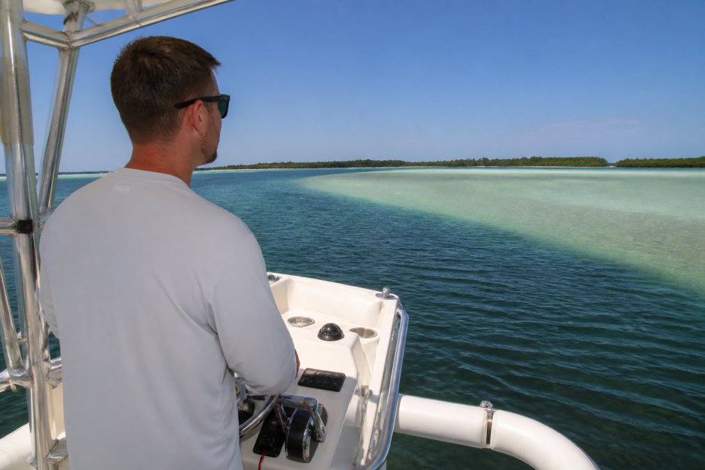
Polarized sunglasses are one of the most underrated boating safety tools. They cut through surface glare and allow you to see beneath the water surface. Polarized lenses work by blocking reflected light waves, allowing you to observe the bottom. Sandbars appear as lighter patches or ridges beneath the surface; grass flats have a distinctly different appearance than sand or mud bottoms.
Many boaters who have switched to polarized lenses report they can navigate shallow water with significantly more confidence, spotting hazards earlier and making course corrections before problems develop.
Using Depth Finders and Navigation Technology
Modern technology supplements visual navigation but should never replace it. Depth finders, GPS plotters, and boating apps provide real-time data about water depth and position. However, technology has limitations, depth finders can malfunction, GPS can lose signal, and apps may have outdated information. The most effective approach combines technology with visual observation and local knowledge.
How Depth Finders Work
Depth finders use sonar to measure water depth by sending a sound wave to the bottom and measuring return time. Most display depth in real-time with alarms that alert you when depth drops below a set threshold. Water temperature, salinity, suspended sediment, and bottom composition affect sonar performance. In very shallow water, some depth finders become less reliable, and weeds can create false readings.
Set your depth alarm conservatively. If your boat draws three feet of water, set the alarm for five feet. This gives you a safety buffer and alerts you before reaching truly dangerous shallows.
Best Boating Apps for Shallow Water Navigation
Apps like Navily and ActiveCaptain provide detailed nautical charts and real-time depth information. Many allow you to download offline charts so you're not dependent on cellular signal. Most integrate with your phone's GPS to show real-time position on nautical charts, and some include tide predictions and current forecasts.
Download charts before you head out. Cellular service can be spotty on the water, and apps without offline charts become useless if you lose signal. Keep your phone charged or bring a backup power source.
Planning Your Route Using Nautical Charts and Tide Tables
Proper route planning begins before you leave the dock. Nautical charts show marked channels, water depths, and known hazards. Tide tables predict water level changes throughout the day. Combining these tools allows you to identify the best time and route for your trip.
Nautical charts use specific symbols and colors to convey information. Blue areas indicate water; brown or tan areas show land; contour lines indicate depth changes; numbers show specific depths at various locations. Tide tables show predicted water levels for specific locations and times. High tide provides maximum water depth; low tide can expose sandbars. The difference between high and low tide can be several feet in some areas (noaa.gov). Current direction and speed also matter, tidal currents can push your boat toward sandbars or help you navigate around them.
Approaching Sandbars: Step-by-Step Technique
The technique for safely approaching and navigating sandbars involves specific steps executed in sequence. Rushing through these steps or skipping any of them significantly increases grounding risk.
Reduce Speed and Post a Lookout
The first and most critical step is reducing speed. Idle speed is the maximum safe speed in shallow water. At idle speed, your boat has minimal forward momentum and can be maneuvered or stopped more easily if you encounter a problem.
Post a dedicated lookout at the bow watching the water ahead and to the sides, looking for color changes, surface texture variations, and any signs of shallow water or sandbars. The lookout communicates with the helmsman using hand signals or radio. If you're operating solo, reduce speed even further and consider avoiding the shallowest areas entirely.
Monitor Your Draft and Water Depth Continuously
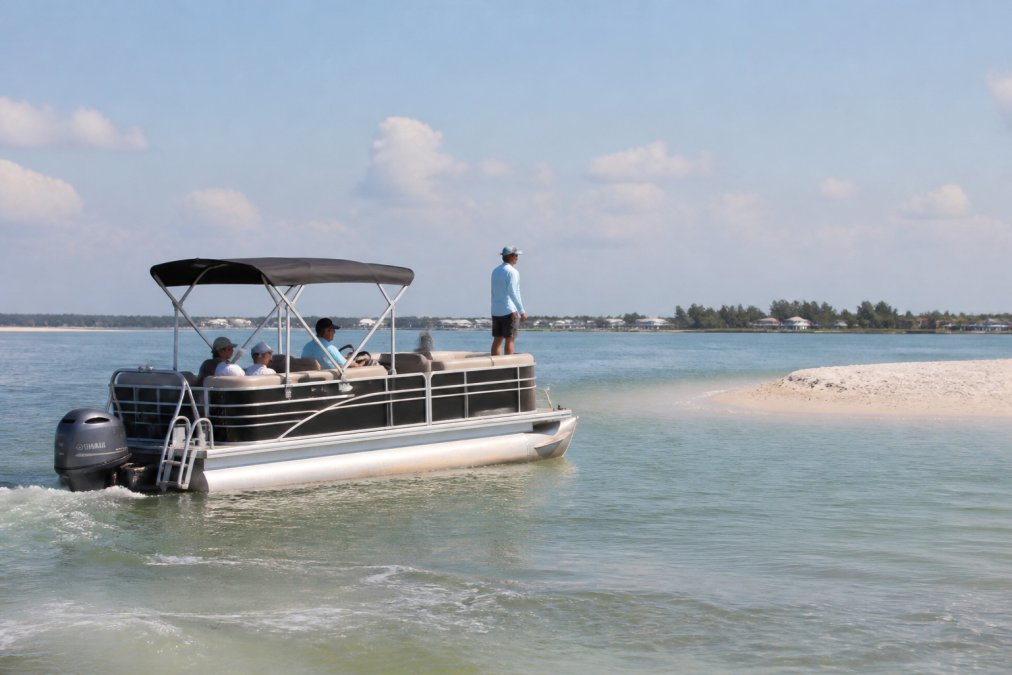
Your boat's draft, the depth of water needed to float it, determines the minimum safe water depth. A pontoon boat typically draws two to three feet; a center console might draw one to two feet; a sailboat with a keel might draw four to six feet (abyc.org). Know your boat's draft precisely and never assume it's safe to enter water shallower than that depth plus a safety margin.
Monitor your depth finder constantly. Watch for trends. If depth is gradually decreasing, you're approaching shallow water. If depth suddenly drops, you may be approaching a sandbar edge.
Book your unforgettable experience today! →
Use Idle Speed in Shallow Water
Idle speed is typically defined as the slowest speed at which your engine maintains steerage (uscgboating.org). Below idle speed, your boat becomes difficult to control. At idle speed, your boat moves slowly enough to avoid damage if you hit bottom but fast enough to maintain directional control.
The cooling intake on your engine draws water for cooling. In very shallow water, your intake might draw sand or sediment, causing engine damage. Some boaters use trim tabs or adjust engine trim to raise the cooling intake higher. Know your engine's specifications and take precautions appropriate to the water depth you're navigating.
How to Safely Anchor a Pontoon Boat
Anchoring securely is essential when you want to stop and spend time in shallow water. A poorly set anchor can drag, putting your boat at risk of drifting into danger. Pontoon boats are particularly vulnerable to anchor dragging because of their light weight and high windage.
Select an appropriate anchor for your boat size and bottom composition. Sand and mud hold anchors well; grass and weeds hold poorly; rocky bottoms can cause anchors to slip. Set your anchor with enough rode, the line or chain connecting your boat to the anchor. A general rule is to use rode length equal to seven to ten times the water depth. In ten feet of water, use seventy to one hundred feet of rode.
Verify your anchor is holding before you leave the helm. Watch landmarks on shore. If your boat is drifting relative to those landmarks, your anchor is dragging. Reset it immediately. Monitor your position periodically, an anchor that was holding perfectly might drag if conditions strengthen.
What to Do If Your Boat Runs Aground
Despite your best efforts, groundings happen. The key is responding correctly to minimize damage and get your boat back into deeper water safely.
Immediate Response Steps
If you feel your boat strike bottom, resist the urge to apply full throttle. Full throttle often digs your boat deeper into the sand and causes significant damage to the propeller, cooling intake, and hull.
Stop your engine immediately. This prevents further damage and gives you time to assess the situation. Check for water entering the boat. If you're taking on water, this is an emergency. Get everyone into life jackets and prepare to abandon the boat if necessary.
Determine how firmly you're aground. If you can rock the boat slightly by shifting weight, you might be able to back off under light power. If the boat is stuck hard, you'll need outside assistance. Many boaters carry a second anchor specifically for this purpose. Call for assistance if you can't free the boat yourself. Don't attempt heroic recovery efforts that risk injuring yourself or causing more damage.
Post-Grounding Damage Assessment
Once you're free or have decided to wait for assistance, assess the damage. Check the hull for cracks or holes. Look at the propeller for bent or damaged blades. Check your cooling intake for sand or debris. Inspect the trim/tilt mechanism if your engine has one.
If you're taking on water, locate the leak and determine if you can seal it temporarily. Bilge pumps should be running continuously. Damage assessment helps you determine whether you can safely operate the boat or need to be towed to a repair facility. Document everything with photos if possible. Your insurance company will want evidence of how the grounding occurred and what damage resulted.
Common Mistakes to Avoid
Most groundings result from preventable mistakes. Learning from others' errors can help you avoid expensive and dangerous situations.
Many boaters ignore depth finder alarms, assuming the alarm is malfunctioning or that they can navigate shallower water than the alarm suggests. Operating at excessive speed in shallow water is another common error. Boaters often maintain cruising speed even as they enter progressively shallower water, assuming they'll see the sandbar before hitting it.
Failure to use polarized sunglasses significantly increases grounding risk. Skipping the lookout step is another frequent mistake. Operating solo in shallow water is inherently more risky. Overconfidence based on previous successful passages is dangerous, water conditions change and sandbars shift. Not understanding your boat's draft is surprisingly common. Ignoring tide and current forecasts is another preventable mistake. Checking tide tables takes five minutes before you leave the dock.
| Common Mistake | Why It's Dangerous | Prevention Strategy |
|---|---|---|
| Ignoring depth alarms | Alarm indicates unsafe depth; ignoring it leads to grounding | Respect alarm settings; slow down immediately when alarm sounds |
| Excessive speed in shallows | High speed prevents maneuvering and increases damage if grounding occurs | Maintain idle speed in water shallower than your draft plus safety margin |
| No dedicated lookout | One person cannot adequately monitor steering and water hazards | Post trained lookout at bow; use hand signals or radio communication |
| Not using polarized sunglasses | Cannot see sandbars or shallow areas beneath water surface | Wear quality polarized sunglasses in bright conditions |
| Skipping tide/current check | Water depth and current direction change throughout day | Check forecasts before departure; plan trips during favorable conditions |
| Unknown boat draft | Cannot determine safe water depth without knowing draft | Ask manufacturer or rental company; add 1-2 foot safety margin |
Navigating sandbars safely requires combining visual observation, technology, proper technique, and respect for water conditions. Start with the fundamentals: reduce speed, post a lookout, monitor your depth continuously. At Little Philly Sea Adventures, we want every boater to return safely from their water adventures. Whether you're renting a boat for the day or taking a guided tour with us, these principles apply. As you gain experience and confidence, you'll develop an intuitive feel for reading water conditions. Book your unforgettable experience today and discover how proper technique transforms shallow water navigation from something to fear into something you can handle with confidence.
Frequently Asked Questions
Q: What are the signs of shallow water or sandbars?
A: Look for color changes in the water, sandbars typically appear lighter tan or brown compared to deeper water. Grass flats show dark patches of seagrass. Choppy water patterns and breaking waves can indicate shallow areas. Using polarized sunglasses helps spot these visual cues. A depth finder will confirm water depth, and tide tables show when water levels drop lowest. Pay attention to marked navigation channels on nautical charts, as they indicate safer, deeper routes.
Q: How do you properly anchor a pontoon boat at a sandbar?
A: Select a spot with 4-6 feet of water depth minimum. Set your anchor in sand or mud, avoid grass flats. Use a 5-to-1 scope ratio (five feet of anchor line for every foot of water depth). Lower the anchor slowly while backing up, then secure the line. Check your position regularly using GPS or landmarks. Keep a lookout for wind and current changes that could drag the anchor. Before anchoring, confirm the area is designated for anchoring and not a marine grass protection zone.
Q: What should you do if your boat runs aground on a sandbar?
A: Stop the engine immediately to prevent propeller damage. Shut off the cooling intake to avoid sucking sand. Assess whether the boat is hard aground or just stuck. Try backing off slowly at full reverse if possible. If stuck, shift weight to the stern and use idle speed to rock the boat. Call for assistance if you cannot free the boat. Inspect the hull, propeller, and cooling system for damage before resuming operation. Document any damage for insurance purposes.
Q: What is the best way to read water depth while boating?
A: Use a depth finder (sounder) as your primary tool, it displays real-time water depth and bottom composition. Install a depth alarm to alert you when approaching shallow water. Combine this with visual cues: lighter water color, visible seagrass, and wave patterns indicate shallows. Consult nautical charts and tide tables before departure to understand the tidal range and depth contours in your planned route. Best boating apps for shallow water navigation include Navily, Waterway Guide, and Navionics, which provide depth data, hazard warnings, and crowd updates at sandbars.
This article was written using GrandRanker
Frequently Asked Questions
Q: What are the signs of shallow water or sandbars?
A: Look for color changes in the water—sandbars typically appear lighter tan or brown compared to deeper water. Grass flats show dark patches of seagrass. Choppy water patterns and breaking waves can indicate shallow areas. Using polarized sunglasses helps spot these visual cues. A depth finder will confirm water depth, and tide tables show when water levels drop lowest. Pay attention to marked navigation channels on nautical charts, as they indicate safer, deeper routes.
Q: How do you properly anchor a pontoon boat at a sandbar?
A: Select a spot with 4-6 feet of water depth minimum. Set your anchor in sand or mud—avoid grass flats. Use a 5-to-1 scope ratio (five feet of anchor line for every foot of water depth). Lower the anchor slowly while backing up, then secure the line. Check your position regularly using GPS or landmarks. Keep a lookout for wind and current changes that could drag the anchor. Before anchoring, confirm the area is designated for anchoring and not a marine grass protection zone.
Q: What should you do if your boat runs aground on a sandbar?
A: Stop the engine immediately to prevent propeller damage. Shut off the cooling intake to avoid sucking sand. Assess whether the boat is hard aground or just stuck. Try backing off slowly at full reverse if possible. If stuck, shift weight to the stern and use idle speed to rock the boat. Call for assistance if you cannot free the boat. Inspect the hull, propeller, and cooling system for damage before resuming operation. Document any damage for insurance purposes.
Q: What is the best way to read water depth while boating?
A: Use a depth finder (sounder) as your primary tool—it displays real-time water depth and bottom composition. Install a depth alarm to alert you when approaching shallow water. Combine this with visual cues: lighter water color, visible seagrass, and wave patterns indicate shallows. Consult nautical charts and tide tables before departure to understand the tidal range and depth contours in your planned route. Best boating apps for shallow water navigation include Navily, Waterway Guide, and Navionics, which provide depth data, hazard warnings, and crowd updates at sandbars.